GLODAP is an international database for oceanographic measurements. The Digital Earth Viewer can be used to explore and investigate the entire dataset.
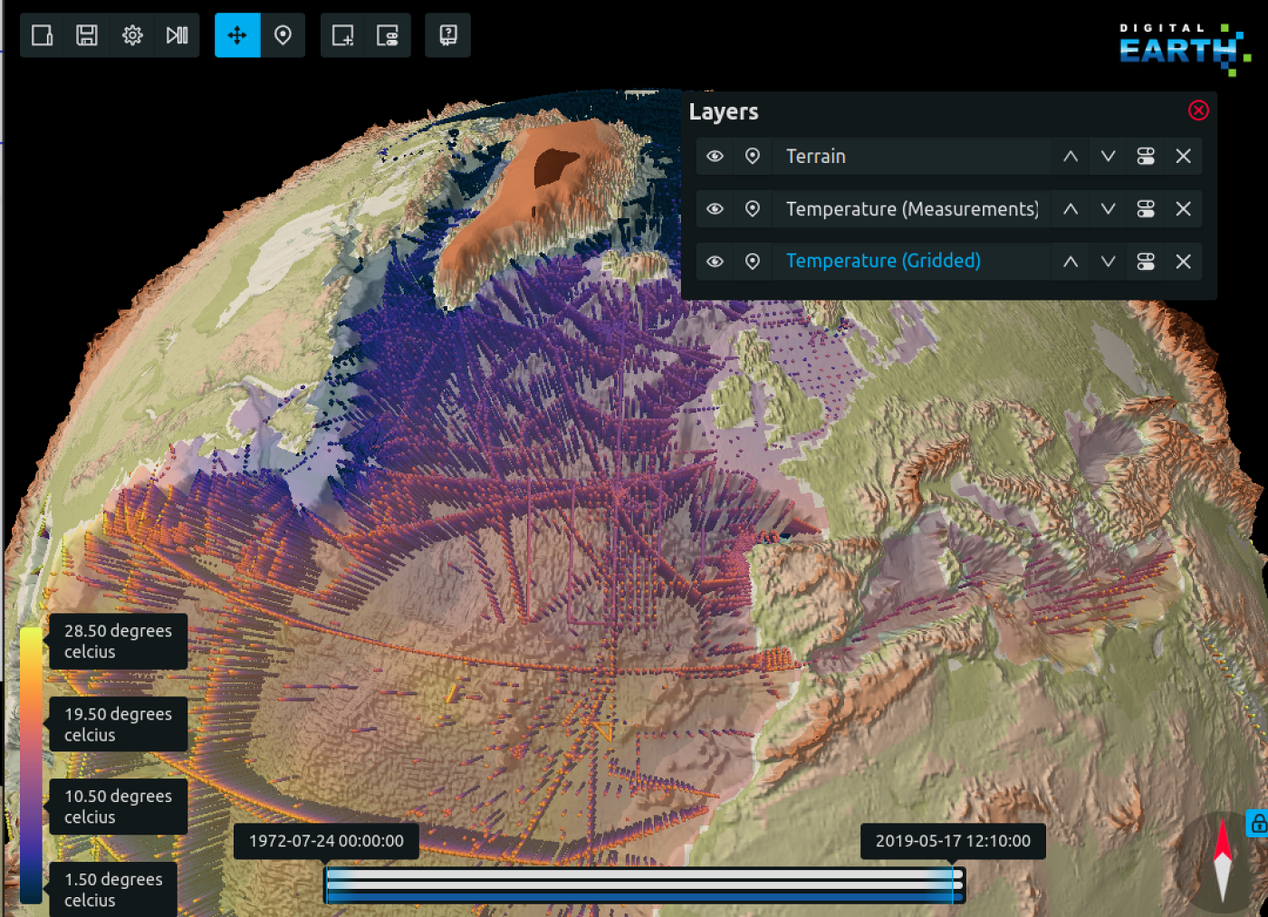
Regular and frequent data updates have become inevitable given the urgency and complexity of climate change. Thus, starting with GLODAPv2.2019 we aim at yearly updates and decadal version releases in concert with the repeated hydrography observation program GO-SHIP. The decadal version releases encompass a full consistency analysis, including the usage of inversion models, of all present cruise data. As this is very time demanding the yearly updates are restricted to the addition- and bias-correction of new cruise data using the most recent GLODAP update as reference. Towards these more regular and frequent releases, the automation of the corresponding workflow is crucial. Presently however, the workflow of GLODAP still includes a fair bit of manual labor with some bottlenecks present. As a seamless data ingestion system with automated data formatting, unit conversion and sanity checks is still under development, the workflow starts with manual acquisition of individual cruise data. Once data is ingested and formatted, the scientific QC (quality control), the most important part of the workflow, has to be performed. The 1st QC (precision checks) is supported through the extensive plotting tool AtlantOS QC (Velo et al. 2020) which enables faster and more consistent decision making. For the 2nd QC (accuracy checks) the crossover toolbox (Lauvset and Tanhua 2015) executes a systematic evaluation of bias. Important to note is that the QC is performed in strong collaboration with the data generator and evaluated with external expert groups. The traceability of the QC decisions is further guaranteed through an online adjustment table. The actual merging routine Make Ocean, implemented through Digital Earth, consequently, executes a large variety of tasks towards the final product automatically. These tasks include for example vertical interpolation, calculation of missing vales using the neural network CANYON-B (Bittig et al. 2018) and the carbon calculation software CO2SYS (van Heuven et al. 2011), a consistent bottom depth calculation, calculation of density surfaces and applying defined adjustments. In the last step of the routine, the actual merge of all data is performed. The resultant consistent data product consists of four regional files and a global file, all available in exchange format and as mat-files. For each new full version release an additional mapping exercise will interpolate the single point data of the core variables on 33 depth-levels horizontally. Eventually, the end-user can then easily get an overview and analyze all data of GLODAP using the Digital Earth Viewer here.A living data product
High quality and intercomparable data – The workflow
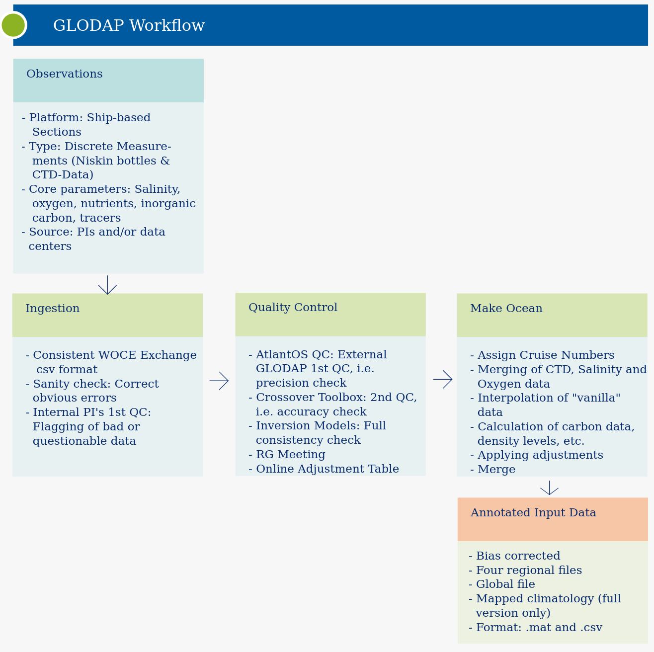
Data Ingestion
Scientific QC
Make Ocean routine
Final product
Refrences